Macedon Ranges
Walk overview
Length: 18.5km circuitTime: 5.5 hours
Grade: Medium
Ascent: 550m
Maximum height: (to come)
Region: Macedon ranges
Map: Melway maps (to come)
(Description to come)
My comments
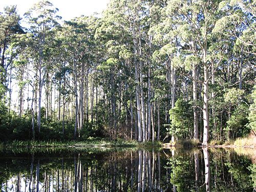
This was a great walk organised by Jane and Guy. We got the hardest part out of the way at the start: a very steep walk up the side of a hill that had most of us panting heavily. Jane seemed to bolt ahead with no problems (though Guy was carrying their pack at this stage).The scenery was fabulous throughout the walk, but the promised wildlife was missing. I only heard one small bird call towards the end of the walk.
The steep descent towards the end of the walk freaked me out a little. There was nothing to hang on to, the track was right on the edge of the mountain with a sheer drop over the edge, and footing was a little dodgy. It was pretty hard on the knees too, however I'd been doing lots of stretching so felt OK.
We did a car shuffle to avoid having to walk the last 1.5km of the walk which would have been on bitumen and uphill - not a nice way to finish what was an otherwise fabulous walk.
My rating
Excellent. I'll definitely do this walk again.Photos from this walk
For more see: Macedon Ranges photo slideshow
Posted by Dey at 7:09 PM | Link to this post
![]()

<< Home