Mt Everard
Walk overview
Length: 18.8kmTime: 5 hours
Grade: Hard
Ascent: 720m
Maximum height: 505m
Region: Kinglake National Park, Victoria
Map: Outdoor Leisure Map, Kinglake National Park
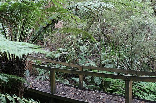
"The forest covered hills of Kinglake National Park tower over the northern suburbs of Melbourne and are the start of the Great Dividing Range. The dry ridges and steep slopes were not suitable for farming and early commercial development was limited to some small gold mines and timber harvesting. The open forest and fern-filled gullies were attractive to visitors and in 1928 the national park was established and has been enlarged several times since then."
"This walk follows a long circuit based on three of the park's higher forested peaks. While only minimal distant views are seen, the forest shade and shelter provide pleasant walking conditions all year round."
Source: Day Walks Melbourne
My comments
It took us 6 hours to complete this walk. I can't see how we'd have done it in 5. Sure, we messed around a little taking photos, but took a very short break for lunch and didn't stop long for rests along the walk. (BTW, doing a search turned up a few pages with conflicting stats for this walk. Some claimed in was 19.6km, another said 22km, others said it was a 6 hour walk, not 5. Whatever the distance, I'd definitely plan on needing 6 hours to do this walk.)The start and finish (you walk back along the first 3.2kms) are beautiful, if a little treacherous. In parts, erosion has taken its toll and the narrow walking track is barely enough to get a single foothold on - the rest slopes away sharply and unevenly. Exposed tree roots, small rocks, and many fallen trees mix things up even more. And the track is covered in leaves which can be quite slippery. At the end of the walk, when tiredness and increasing damp and cold saw us both slipping and tripping our way through this section of the walk, I couldn't believe it when I realised Chris was checking his email and making a phone call - and tempting fate! But it is a really gorgeous few kilometres. Dense undergrowth, tall ferns and other greenery give it a jungle feel. We loved it.
The remainder of the walk wasn't quite as pretty, but was still enjoyable. There was a mix of walking tracks, maintenance tracks and a short section of unsealed road. There's a very narrow descent just after Mt Everard and while you have to keep your wits about you, it wasn't as technically difficult as the descent we encountered towards the end of the Macedon Ranges walk. The toughest part of the walk was probably Mt Jerusalem Track because of the long ascent (though it was fairly gradual) towards the end of the walk.
There was 720 metres of ascent in total, which is more than we've done before. The gradual incline meant that it didn't seem as tough as climbing the 1000 steps in the Ferntree Gully Forest. Lots of downhills on this walk got my left knee acting up again - a few stretches relieved it. And it was an 18.8km walk, so by the time we got back to the car, we were both pretty tired.
My rating
Excellent. But I wouldn't do it in wet weather, given the condition of the first few kilometres of the walk.Photos from this walk
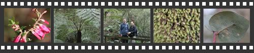
For more, see: Mt Everard photo slideshow
Posted by Dey at 10:55 PM | Link to this post
![]()

<< Home