Sunday, September 17, 2006

Werribee Gorge

Photo: Rock layers in Werribee Gorge

Walk overview

Length: 10.0km
Time: 4 hours
Grade: Medium
Ascent: 405m
Maximum height: 360m
Region: Goldfields, Victoria
Map: Meridien Productions 1:20,000 Lerderderg and Werribee Gorges

"The dominant geological feature to the west of Melbourne is the Rowsley Fault. East of this fault lies the plains surrounding Port Phillip Bay while to the west is the uplifted plateau that extends to Ballarat. The Werribee River has cut deeply into this plateau creating a rugged steep-sided gorge."

Source: Day Walks Victoria

My comments

We did just the Gorge circuit walk this time, having done a much longer walk in August last year that took in Falcon's Lookout and involved a couple of river crossings.

It was a beautiful day and there were several groups out walking - though many, many more cars parked in the carparks at various picnic spots.

We started from the Quarry picnic area and walked counter-clockwise around the circuit. It was great to start the walk with the fabulous views offered by the various lookouts at the top of the gorge. I was worried there would be a lot of downhill, since we seemed to be up so high, but before we knew it we were level with the river and scrambling over rocks or shuffling along rocky ledges.

Needles Beach had been claimed by a couple of hopeful fisherman, though I'm not sure they'd have gone home with much. After some more rock scrambling and a few attempts at taking photos that made it look more difficult than it was, we reached Lions Head Beach.

After walking along the old aqueduct we reached Meikle's Point picnic ground where we stopped for lunch. From there it was only about a half hour walk back to the car - but a fair bit of it was uphill and I thought the rest of the group were going to mutiny at one point when they thought there was another uphill section coming.

My rating

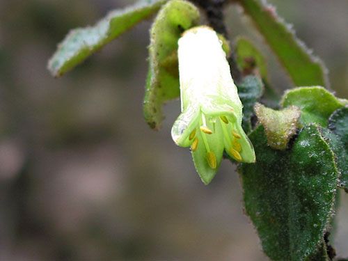
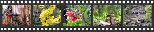
Excellent. The walk seemed much easier this time - not having to cross the river (with my wobbly knees) might have made all the difference.

Photos from this walk


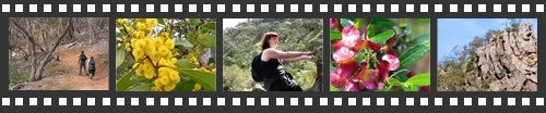
For more, see: Werribee Gorge photo slideshow

Sunday, September 03, 2006

Masons Falls Circuit, revisited

Photo: wildflower

Walk overview

Length: 13.5km circuit
Time: 4.5 hours
Grade: Medium
Ascent: 420m
Maximum height: 570m
Region: Kinglake National Park, Victoria
Map: Outdoor Leisure Map, Kinglake National Park

"Just north of Melbourne is the Kinglake Ntional Park. It was established in 1928 and has been extended several times since. The park is composed of four large blocks which are separated from each other by private property. The oldest section of the park is the Sugarloaf Block and this contains the popular Masons Falls and a lookout at Mt Sugarloaf. These features are linked by a series of walking tracks and management roads that provide an excellent circuit walk."

"A major feature of this walk is the wide variety of plants. The track initially follows a high ridge covered with messmate forest then descends into a fern-filled gully where blackwood, wattles,
pomaderris and tree-ferns dominate. Many orchids, lilies, daisies, correas and grevilleas are also found in the forest. This diversity of plant life means there is always something flowering."

Source: Day Walks Melbourne

My comments

The weather we had for our walk today was almost the same as for the first time I did this walk in June last year. It rained lightly for the first hour or so and the forest was cold and misty. We were soon warm though, and also excited - approaching the top of Mt Sugartop we saw a group of lyrebirds - the first of many sightings for the day.

As we headed west along Running Creek Track we started to notice lots of different wildflowers. It was a little hard to photograph them in the rain, but it eventually eased off and we had two camera clicking away.

As if by magic, the sun started shining as we descended into the glade known as The Tryst. All the wet ferns glistened in the morning sunlight and everyone was feeling very glad they'd been talked into coming along, despite the doubtful weather forecast. We had patches of sunlight as we made it to Hazel Glade, and took lots of photos of fungi and wildflowers. We also spotted more lyrebirds and were able to get pretty close - close enough to try for a photo.

It was quite late by the time we arrived at Masons Falls - we'd been taking so many photos, the time had really flown by. The sun went in long enough for us to get a couple of photos of the falls (they really need to be photographed in the morning, when the sun is in a better position), and didn't really appear much when we stopped for a late lunch at the nearby picnic grounds.

We finished the walk along Boundary Road, taking almost an hour more than the suggested time. Everyone agreed it had been worth the effort, and I'm sure I'll not be the only one of us eager to do the walk again some time.

My rating

Excellent.

Photos from this walk

Photo filmstrip with highlights from Masons Falls walk
For more, see: Masons Falls Circuit photo slideshow