Sunday, January 08, 2006

Ferntree Gully Forest - a third time

Photo: 1000 steps

Walk overview

Length: 11.4km circuit
Time: 4 hours
Grade: Medium
Ascent: 700m
Maximum height: 500m
Region: Dandenong Ranges National Park
Map: Melway maps 65, 74

"The forest near Ferntree Gully has always been a popular destination for a brief escape from the nearby city. First reservedin 1882, it became a national park in 1927 and in 1987 was merged with nearby Sherbrooke and Doongalla Forests into the Dandenong Ranges National Park. A network of walking tracks and closed fire management tracks penetrate the forest providing pleasant year round walking."

Source: Day Walks Victoria

My comments

I did this walk for a third time today. I was looking for a shorter walk since the forecast was for very warm weather, and I wanted to make sure I wouldn't get lost since I was walking on my own.

Again, I finished the walk in just under 3.5 hours. I might have been quicker except I took the camera and got a few more photos. Also, my knee played up again - this time at the steep descent on View Track. I'll have to get it looked at.

My rating

Good. A great training walk and a good way to judge your fitness.

Photos from this walk

Photo filmstrip with highlights from Ferntree Gully Forest walk
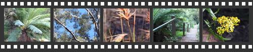
For more see: Ferntree Gully Forest photo slideshow

Monday, January 02, 2006

Bungal Forest

Photo: Sign at the entrance to Bungal Forest

Walk overview

Length: 16km
Time: 6.5 hours, minimal breaks
Grade: Medium
Region: Port Phillip
Map: Vicmap 1:25,000 Yaloak

"Upstream of the confluence of Moorabool River West Branch and East Branch is a pocket of attractive forest. It is surrounded by undulating farmlands and bordered by Bungal Creek and Moorabool River East Branch. The streams have eroded relatively deep, creating small cliffs, rock pools, and steep interlocking spurs. The forest seems to be rarely visited by walkers. In spring thousands of orchids bloom; in summer swimming in the rock pools could interest many, while in winter the surrounding countryside is emerald green. The forest covers only 7 square kilometres and lies south of Ballan."

Source: 120 Walks in Victoria

My comments

The first half of this walk was quite easy - a couple of short uphill sections, but all along well-defined (mostly 4-wheel drive) tracks. After going bush to walk along the river, the walk got a little more interesting. We had to pick a path to follow the river, taking care not to get too low (we ran out of ground early on), or too high (where later on we lost sight of the river).

We heard shooting (prohibited in state parks) and were a little worried about going too much further south in case we got too close. We ended up cutting west a little too early, and probably shortened the walk by a kilometre or two as a result, finishing about 5 and a quarter hours after we set off.

It was a warm day after rain yesterday and the forest smelled beautiful - fresh eucalyptus and methol. A delightful day.

Photos from this walk

Bungal Forest photos
For more, see: Bungal Forest photo slideshow