Saturday, June 25, 2005

Mt Dandenong

Photo: Walking along a track on Mt Dandenong

Walk overview

Length: 15.5km
Time: 5 hours
Grade: Medium to hard
Ascent: 640m
Maximum height: 633m
Region: Dandenong Ranges, Victoria
Map: VICMAP Kilsyth
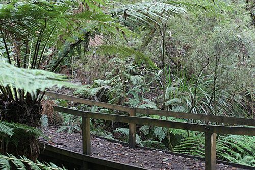
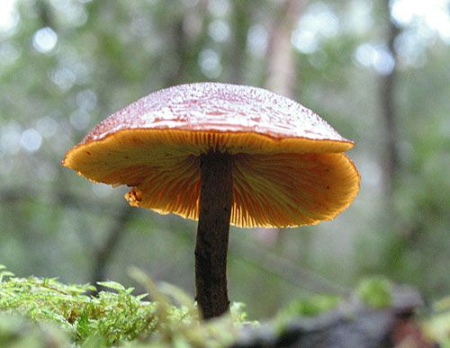
"Melbourne's mountain is undoubtedly Mt Dandenong. Looming over the eastern suburbs, its slopes contain some fine forested and treefern lined tracks. Being so close to the city is has been extensively developed. The summit contains a lookout and restaurant (currently closed) and there is also a series of tall television transmission towers along its skyline. Less known but just as interesting, are the grounds and gardens of the old Doongalla estate. While the main house was destroyed by bushfire in 1932, the park-like grounds provide an interesting contrast to the surrounding eucalypt forests. Bushfires are regular events on the mountain and a network of management tracks exist to facilitate fire fighting. These tracks are close for public vehicle access and provide good walking."

Source: Day Walks Victoria

My comments

Jane and Guy organised this walk, and a bunch of their friends came along (David, who we'd met on the Macedon Ranges walk, Liz and Andrew, and Judith and Karl), and our colleague Scott, making it a more social occasion than our usual two-person walks.

On the advice of a local Parks person, we skipped the first rocky uphill section of the walk and took the road up to the fire station where we found the walking track behind a small reserve. We made our way to the summit lookout at Mt Dandenong without problem and stopped for coffee.

Re-starting the walk, we felt a little lost because the track nearest the summit lookout was marked as a short circuit and didn't have signage indicating the track name (Kyeema Track). We walked around a little looking to see if there was an alternative track, and finding nothing else promising, we headed off and soon found we were on the right track.

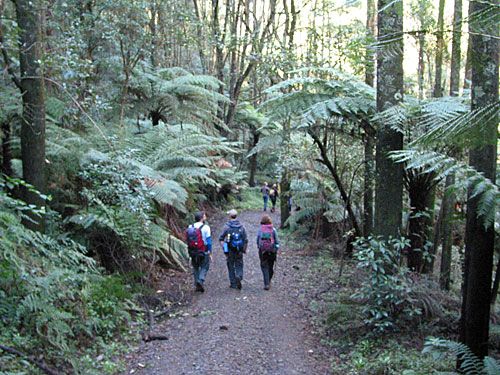
Kyeema track runs along a ridge from where you can get great views of the south eastern suburbs of Melbourne. The track then turns down to meet Dacite track, and becomes very rough and slippery. A four-wheel drive had recently been over the track making it even more squishy and difficult to walk.

Our next navigational challenge turned out to be a physical challenge as well. We took a wrong turn and had to scramble up an extremely steep and slippery track. Several people slipped and fell. I managed to capture a couple of photos of the mayhem, but was too busy gripping a tree fern and trying to maintain my footing to get any more. When we finally reached the top, our error was discovered, and there was some moaning and groaning (mainly from me) about the tough task of getting back down again. Some slid and bumped their way down on their bottoms, others did the downhill partly by walking in the rough off the track. This definitely taught me about the value of walking poles. I'm going to buy some!

The weather was fine, and when we rounded the track near Doongalla Estate, the sunlight was breaking through the trees. We stopped in the park-like gardens of the estate for lunch, sampling some of the goodies that had been brought along including craisins (dried cranberries, yum!) and sweet chilli and coriander rice crackers (full of MSG, but tasty!).

The remainder of the walk was pleasant and without incident. We finished up at around 3pm (having started just before 10am) and some headed off for tea and cakes, while others went home for a quick nap before going out for the evening.

My rating

Good. Avoid during wet periods because parts of the track are extremely slippery.

Photos from this walk

Photo filmstrip with highlights from Mt Dandenong walk
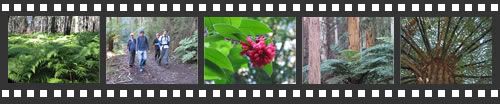
For more, see: Mt Dandenong photo slideshow

Saturday, June 18, 2005

Mt Everard

Photo: Bridge over creek amongst lush ferns

Walk overview

Length: 18.8km
Time: 5 hours
Grade: Hard
Ascent: 720m
Maximum height: 505m
Region: Kinglake National Park, Victoria
Map: Outdoor Leisure Map, Kinglake National Park

"The forest covered hills of Kinglake National Park tower over the northern suburbs of Melbourne and are the start of the Great Dividing Range. The dry ridges and steep slopes were not suitable for farming and early commercial development was limited to some small gold mines and timber harvesting. The open forest and fern-filled gullies were attractive to visitors and in 1928 the national park was established and has been enlarged several times since then."

"This walk follows a long circuit based on three of the park's higher forested peaks. While only minimal distant views are seen, the forest shade and shelter provide pleasant walking conditions all year round."

Source: Day Walks Melbourne

My comments

It took us 6 hours to complete this walk. I can't see how we'd have done it in 5. Sure, we messed around a little taking photos, but took a very short break for lunch and didn't stop long for rests along the walk. (BTW, doing a search turned up a few pages with conflicting stats for this walk. Some claimed in was 19.6km, another said 22km, others said it was a 6 hour walk, not 5. Whatever the distance, I'd definitely plan on needing 6 hours to do this walk.)

The start and finish (you walk back along the first 3.2kms) are beautiful, if a little treacherous. In parts, erosion has taken its toll and the narrow walking track is barely enough to get a single foothold on - the rest slopes away sharply and unevenly. Exposed tree roots, small rocks, and many fallen trees mix things up even more. And the track is covered in leaves which can be quite slippery. At the end of the walk, when tiredness and increasing damp and cold saw us both slipping and tripping our way through this section of the walk, I couldn't believe it when I realised Chris was checking his email and making a phone call - and tempting fate! But it is a really gorgeous few kilometres. Dense undergrowth, tall ferns and other greenery give it a jungle feel. We loved it.

The remainder of the walk wasn't quite as pretty, but was still enjoyable. There was a mix of walking tracks, maintenance tracks and a short section of unsealed road. There's a very narrow descent just after Mt Everard and while you have to keep your wits about you, it wasn't as technically difficult as the descent we encountered towards the end of the Macedon Ranges walk. The toughest part of the walk was probably Mt Jerusalem Track because of the long ascent (though it was fairly gradual) towards the end of the walk.

There was 720 metres of ascent in total, which is more than we've done before. The gradual incline meant that it didn't seem as tough as climbing the 1000 steps in the Ferntree Gully Forest. Lots of downhills on this walk got my left knee acting up again - a few stretches relieved it. And it was an 18.8km walk, so by the time we got back to the car, we were both pretty tired.

My rating

Excellent. But I wouldn't do it in wet weather, given the condition of the first few kilometres of the walk.

Photos from this walk

Photo filmstrip with highlights from Mt Everard walk
For more, see: Mt Everard photo slideshow

Saturday, June 11, 2005

Masons Falls Circuit

Photo: Fungus found on Mason Falls Circuit

Walk overview

Length: 13.5km circuit
Time: 4.5 hours
Grade: Medium
Ascent: 420m
Maximum height: 570m
Region: Kinglake National Park, Victoria
Map: Outdoor Leisure Map, Kinglake National Park

"Just north of Melbourne is the Kinglake Ntional Park. It was established in 1928 and has been extended several times since. The park is composed of four large blocks which are separated from each other by private property. The oldest section of the park is the Sugarloaf Block and this contains the popular Masons Falls and a lookout at Mt Sugarloaf. These features are linked by a series of walking tracks and management roads that provide an excellent circuit walk."

"A major feature of this walk is the wide variety of plants. The track
initially follows a high ridge covered with messmate forest then
descends into a fern-filled guylly where blackwood, wattles,
pomaderris and tree-ferns dominate. Many orchids, lilies, daisies,
correas and grevilleas are also found in the forest. This diversity of
plant life means there is always something flowering."

Source: Day Walks Melbourne

My comments

The forecast was "rain clearing later" and it was raining when we started the walk, but I'm glad we decided to go ahead. The messmate forest was misty and atmospheric in the light rain. The light ferny undergrowth became more dense a few kilometres into the walk. When we reached the valley the rain stopped and everything was glistening in the light--green and lush. It was absolutely beautiful. Listening to the water running in the creek alongside the walking path added to the ambience.

Masons Falls, which we reached 3.5 hours into the walk, were more impressive than I'd imagined they'd be, but it was hard to get any decent photos shooting directly into the sun (under the shade of Chris's trusty umbrella that we'd used to cover the camera in the rain earlier in the day).

The walk felt like it was over not long after we'd begun, probably because we were fairly engrossed in the environment, and I took quite a lot of photos, despite the rain and poor light in places.

My rating

Excellent. Definitely a walk I'll do again.

Photos from this walk

Photo filmstrip with highlights from Masons Falls walk
For more, see: Masons Falls Circuit photo slideshow

Sunday, June 05, 2005

Birds Land

Photo: birds in the lake at Birds Land Reserve

Walk overview

Length: 10.5km circuit
Time: 3.5 hours
Grade: Medium
Ascent: 250m
Maximum height: 230m
Region: Dandenong Ranges, Victoria
Map: Melway maps 83, 84

"Nestling in the foothills of the Dandenong Ranges, not far from Belgrave, is a small park with the unusual name of Birds Land. Although rich in bird life, this reserve owes its name not to the birds but to a former owner..."

"Two man-made lakes, part of the Monbulk Creek Retarding Basin, are home for numerous ducks and water hens... Entering Lysterfield Lake Park the scenery takes on a more natural feel as eucalypt forest predominates. With luck, wallabies may be seen feeding in the grassland close to the shelter of the forest".

Source: Day Walks Melbourne

My comments

We decided to do an extra walk this weekend after yesterday's disappointing effort. The weather was perfect again--clear skies and cool, with just the tiniest sprinkling of rain for a few minutes at the start.

The reserve was filled with people walking dogs and feeding the birds, but we didn't see many people once we'd left the reserve: just a couple of guys mountain-biking, and two women who were out for a Sunday stroll rather than a strenuous walk. Chris was happy to see some Tibetan spaniels out for a walk, and their owner confirmed that the females of the breed have less than ideal temperaments (though anyone who has met Poppy would already know this).

Chris took his GPS unit again, and it performed well except for a small map discrepancy - I've no idea whether the GPS or the map was to blame. I was responsible for us missing a turn (and the GPS didn't alert us), and we then had to backtrack up a very steep hill, right after I'd commented that I was glad we were walking down and not up it!

I'd grade the walk easy to medium, since there wasn't a lot of climbing and no difficult terrain to negotiate. A good walk to do when you're not very fit or don't have a lot of time.

It would also be a nice place to take the family/dogs for a picnic and for those not inclined to exercise to relax and have a read while the walkers do their thing.

My rating

Good. I'd happily repeat this walk again some time.

Photos from this walk

Photo filmstrip with highlights from Birds Land walk
For more see: Birds Land Reserve photo slideshow

Saturday, June 04, 2005

Mordialloc and Carrum

Photo: boats moored in Patterson River

Walk overview

Length: 18.8km circuit
Time: 5.5 hours
Grade: medium to hard
Ascent: 10m
Maximum height:10m
Region: Eastern shore of Port Philip Bay, Victoria
Map: Melway maps 92, 93, 97

"The eastern shore of Port Philip Bay is a long beach backed by the southern suburbs of Melbourne. The firm sand provides easy walking with views of the bay and the ever present boats and seabirds. This walk follows the beach from Mordialloc to Carrum and then heads inland to the Edithvale Wetlands. The 101 hectare wetlands are a remnant of the Carrum-Carrum Swamp that once covered more than 10,000 hectares. The swamp was drained in 1879 by construction of the Patterson River and much of the area was then used for farming and later developed for housing. The remnant wetlands were first regarded as being just drains for flood control but are now recognised as being important refuges for birds and native vegetation. A combined walking and cycling path passes through the wetlands and is used to return to Mordialloc."

Source: Day Walks Melbourne

My comments

Chris finally succumbed to temptation and bought a GPS unit that works with his Treo 650. Not that we could have gotten lost on this walk. The route was very straightforward.

In fact, the back half the walk was boring. So boring, I'd never do it again. The path was almost dead straight for several kilometres. And the environment was barely wetlands and more accurately described as suburban.

I would grade the walk as easy-medium. I've got no idea how it could be rated medium-hard. It was very pedestrian.

My rating

Poor.

Photos from this walk

Photo filmstrip with highlights from Mordialloc-Carrum walk
For more see: Mordialloc-Carrum photo slideshow