Saturday, September 24, 2005

Andrew Hill

Photo: Wildflowers

Walk overview

Length: 11.4km
Time: 4 hours
Grade: Medium
Ascent: 450m
Maximum height: 625m
Region: Kinglake National Park
Map: VICMAP 1:25,000 Outdoor Leisure Map, Kinglake National Park

"The Wombelano Block forms the north-eastern end of Kinglake National Park. As it is just north of the Great Dividing Range it receives less rainfall than the rest of the park. The area contains a drier forest of Messmate and supports less understorey vegetation due to the lower rainfall."

"For many years this forest was logged until 1980 when it was added to the Kinglake National Park. There are a number of walking tracks which follow old roads. This was follows tracks over the forested summit of Andrew Hill which is the highest in the block."

Source: Day Walks Melbourne

My comments

We drove through rain to reach the starting point for the walk, but the weather cleared just before we began. This didn't last, however, and we had light misty rain for about 2 hours. This made the track a little slippery, but after slipping and sliding last week, this time I was prepared - I bought some walking poles during the week and wanted to try them out before trekking in Nepal. They seemed to save my knee some strain and I managed to stay on my feet for the whole walk. A fair amount of debris on the track led to a bit of tripping, and some large trees have fallen in recent months. A bridge over a gully had collapsed, though we did manage to find an alternative route. A sign would be useful. Other than this, the route was very accessible.

An easy walk in pleasant surroundings, but a very long drive to get there.

Photos from this walk

Byers Back Track photos
For more, see: Andrew Hill photo slideshow

Sunday, September 18, 2005

Byers Back Track and Shaws Lake

Photo: Chris walking along the aqueduct track

Walk overview

Length: 18.0km
Time: 7 hours (we took just over 6 hours)
Grade: Hard
Ascent: 350m
Maximum height: 650m
Region: Goldfields, Victoria
Map: Meridien Productions 1:35,000 Lerderderg and Werribee Gorges

"In the 1850s gold rush miners scoured the hills and valleys around Blackwood searching for the elusive metal. While not as ruck as other gold fields, the Lerderderg River contained some gold, and miners cleared the forest and dug over extensive areas. After the gold rush the forest regenerated and covered many of the mining areas. The most visible mining remains are the aqueducts that carried water from the river to the mining areas. The water was used to separate the gold from the gravel and dirt."

"One of the longest remaining aqueducts is Byers Back Track. The level walking track starts above O'Briens Crossing and follows the Lerderderg River valley north-west towards Blackwood. This walk then enters Blackwood, passes Shaws Lake which was constructed to store water for mining operations, then follows a long ride to The Tunnel. This narrow slot was cut by miners to divert the river so that they could scour the river bed for gold. This diversion of the Lerderderg River has become permanent."


Source: Day Walks Melbourne

My comments

A longish, but otherwise easy walk on mostly level tracks. The Tunnel is amazing and certainly worth a visit to see.

I had another couple of slips and falls today. It seems the Lerderderg has it in for me, as it's the only place where I've managed to end up on my backside - and several times at that!

Another map-related problem. The right turn at the 6.1km mark on the Melbourne Day Walks map is described in a slightly confusing way. If you do this walk, don't turn right at the wide track here. Walk up the hill in front about 10 metres and then turn right where the aqueduct track begins again. The very obvious track to the right is not marked on the map (or on the Meridien map).

Photos from this walk

Byers Back Track photos
For more, see: Byers Back Track photo slideshow

Saturday, September 10, 2005

Boar Gully

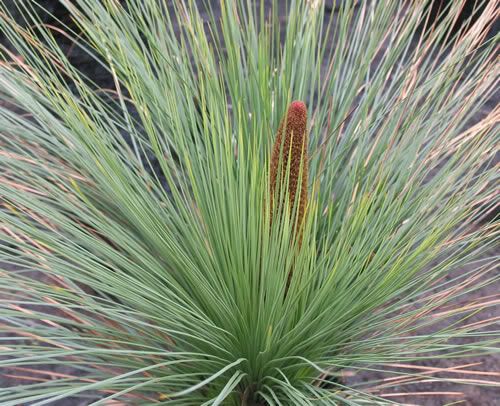
Photo: Grass tree

Walk overview

Length: 13.8km
Time: 5.5 hours (we took 5 hours, walking at a very leisurely pace)
Grade: Medium
Ascent: 310m
Maximum height: 430m
Region: Brisbane Ranges National Park
Map: Bushmaps 1:50,000 Brisbane Ranges National Park

"The forests of the Brisbane Ranges National Park are among the richest wildflower areas in Victoria with over 600 species being recorded including many orchids. Common flowering plants are grevilleas, hakea, wattles and bush-peas. Nobody could miss the outstanding display of grass trees that form an extensive understorey for much of the walk. Late winter and spring is the best time to visit for the wildflower displays. Native fauna, too, is often to be seen including eastern grey kangaroos, wallabies, echidnas and koalas."

"The main landscape feature is the Rowsley Fault. This runs along the easter edge of the range and has created a plateau to the west which overlooks the plains that stretch towards Port Phillip Bay. Easy walking is available on old roads closed to vehicles and little used bush tracks."

Source: Day Walks Victoria

My comments

A fairly easy, flat walk in pleasant environs. The wildflowers (we saw three kinds of wattle and pink and white bush-peas) were in flower, but did not give the kind of presence indicated in the walk description. The grass trees were superb. Lots of controlled burning over the past few months has given the place a slightly eerie feeling.

If you do this walk, don't park in any of the numbered parking bays in the Boar Gully camping area. These are frequently reserved by camping groups. Fortunately, we were still with the car when a group who'd booked the area we'd parked in turned up, so we were able to move out of their way.

A couple of map-related problems. First, we could not find any 'faint track' leading off to the right of Quarry Track and up to Thompson's Track, despite walking up and down Quarry Track three times and going off the trail a hundred metres or more trying to find it. Late when we walked along Thompson's Road we tried to locate the end of the mysterious track, but couldn't see anything obvious from that end either.

Second, we turned onto a track that was not marked on the map and ended up circling back onto a part of the track we'd walked in the morning. When you're walking along Old Thompson's Track, ignore the first turn to the left and go on to the next one to avoid this.

Photos from this walk

Boar Gully photos
For more, see: Boar Gully photo slideshow